|
|
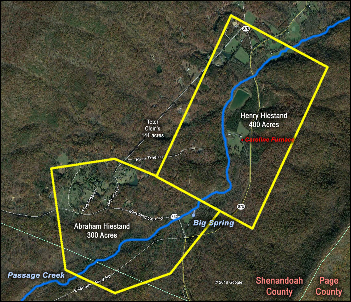
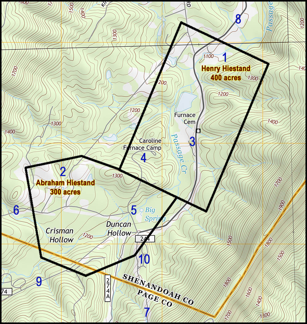
Fort Valley Hiestand Property on Massanutten Mountain
|
 |
|
|
1 = Henry Hestant's (Hiestand) 400 acres, purchased from
Peter Tear in 1756 (surveyed October 4, 1751 for Gervas Daugherty) but
was not entered into the grant book until June 3,
1778. Deed
2 = Abraham Hestant's (Hiestand) 300 acres, assigned by
David Clem (Klemm) "in the upper part of Powell's Fort above the
Massanutten Path on Passage Creek" on October 5, 1763 but not entered
into the deed book until March 26, 1777.
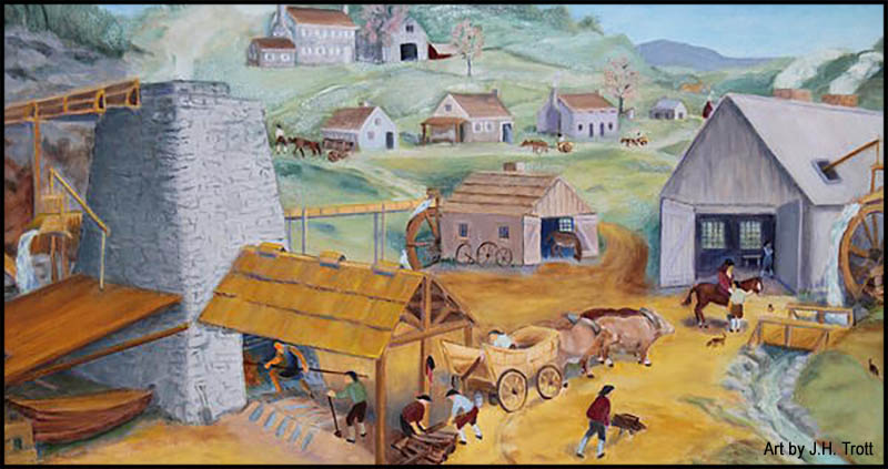
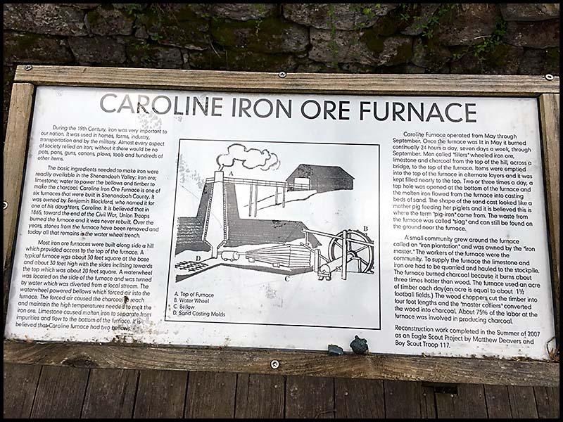
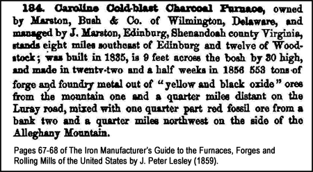
Deed 3 = Current location of the office and other facilities of the Caroline Furnace Lutheran Camp and Retreat Center. Historic location of the Caroline Iron (Cold-blast Charcoal) Furnace from the mid-1830s until 1865 when it was destroyed by the Union Army because of its contribution to the Confederate cause. In its hey-day, there was a very large pig iron operation going on here. The ruins of the furnace still remain at this location.
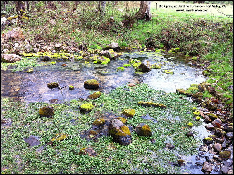
5 = The "Big Spring" (said to produce 700 gallons per minute) was, during the time of the furnace's operation, channeled for about one-half mile from where the Big Spring emerges from underground to the water wheel of the furnace. The spring still produces an abundant flow of crystal clear cold water.
6 = Moreland Gap Road (Virginia Route 730) - approximately nine miles to Highway 11, connecting with Highway 11 at about half way between Mount Jackson and New Market, VA. 7 = Virginia Route 675 - approximately six miles from Bixler Bridge on the South Fork of the Shenandoah River, essentially the location of Henry Hiestand's land east of the river.
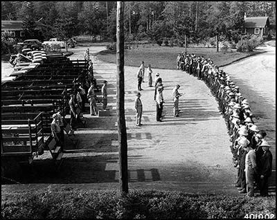
8 = Camp Roosevelt Road (Virginia Route 67) - approximately 24 miles through Fort Valley to the Strasburg Road (Virginia Route 55) on the north end of the valley. 9 = Crisman Hollow Road (Virginia Route 274) - approximately six miles to the New Market Gap (about halfway between Luray and New Market, VA) on Lee Highway (Virginia Route 211). 10 = Camp Roosevelt was America's first (of many) CCC (Civilian Conservation Corps) camps. President Franklin Delano Roosevelt began the CCC. Camp Roosevelt was in operation here from 1933 to 1942. (Photo on right)
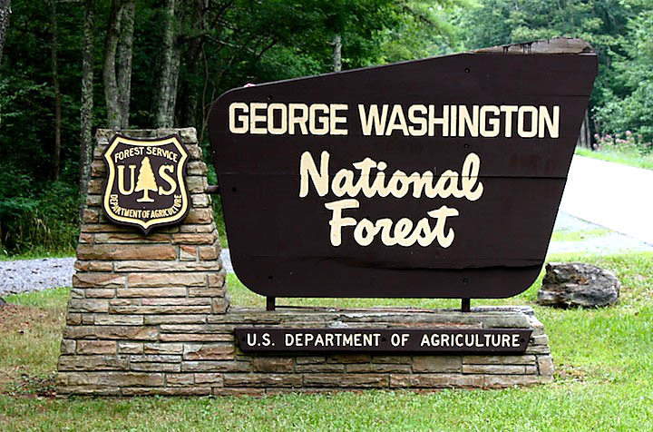
George Washington National Forest
Fort Valley, including the land once owned by Henry and Abraham Hiestand, has been in the George Washington National Forest since the forest (originally named Shenandoah National Forest) was established on May 16, 1918. |
||
|
 4 = Current location of cabins,
dining hall, and other facilities of the
Caroline Furnace Lutheran Camp and Retreat Center.
4 = Current location of cabins,
dining hall, and other facilities of the
Caroline Furnace Lutheran Camp and Retreat Center.