The Heritage of Daniel Haston


Miscellaneous Notes - Haston Big Spring Area


Kirkland's Store - "E. Kirklen & Sons"

On October 19, 1835, the voting precinct which had formerly been at David Haston's house was moved to Kirkland's Store.  Source:  Original page 46 of the WPA transcriptions of White Co, TN Court Minutes & Court of Pleas and Quarter Session, 1835-1841

Kirkland's Store was probably located very near the home of David Haston.  Jacob Mitchell sold his 50 acre tract (north of and adjacent to the 150 acre tract settled by Daniel Haston) to Pleasant White on February 2, 1822.  Source:  Page 257 of White County, TN Deed Book K, TSLA microfilm roll # 63

On January 5, 1837 Elisha & John Kirkland purchased this 50 acre tract from Pleasant White.  [Source:  Pages 326-327 of White County, TN Deed Book K, TSLA microfilm roll # 63]  If the original Jacob Mitchell place was the location of Kirkland's Store, it would literally just have been a "stone's throw" from David Haston's house (original home place of Daniel Haston).  (see Big Spring area map for the original Jacob Mitchell place)

On June 25, 1841, Elisha Kirklen purchased 48 acres from Terry Gillentine that had been a part of (on the west end) of Daniel Haston's original 150 acres.  Apparently, Isaac Haston had sold it to William Shockley who sold it to Terry Gillentine. 

But the Kirkland Store was established sometime before October 19, 1835, according to the election precinct information given in the White County court minutes (see above).  When Pleasant White sold this land to the Kirklands in 1837, he was living in Rutherford County, TN, according to information on the deed.  Thus, it is possible or likely that the Kirklands had leased the land from Pleasant White before purchasing it. 

One 1842 Van Buren County, TN court source refers to the official name of the store as E. Kirklen & Sons.  Elisha Kirklen (from Bledsoe County) was apparently the father and chief owner.  George W. Kirklen & Ephriam Kirklen are also mentioned as co-owners on this document.  Source:  May 14, 1842 entry in Sparkmantown (Van Buren County, TN) J.P. Court records, located in the "big house" of George Sparkman II's plantation by Bob Roberts of Walling, TN and in his possession as of 2004.

On May 14, 1836 Isaac Haston owed John Kirkland a sum of $40.92.  We might assume that this was a grocery bill debt.  Source:  Page 445 & 448 of White County, TN Deeds Book "I" (on microfilm #63).


 Meeting House & School
Under Oversight of Robert Gamble, William Denney, & Abijah Crain
1832 & following...if not earlier

December 24, 1832 Deed
Wyat Ogle
to Robert Gamble,
William Denney,
& A. Crain

The State of Tennessee & Wyat Ogle of the County of White and State of Tennessee on this day give free and clear of any price whatsoever a piece of ground lying and being in the County & state aforesaid containing one acre of land including the house built on it clear of any claim of me or any other person for __ what__ the above land and house I give into the hands and care of Robert Gamble, William Denney an A. Crain of the County of White and State aforesaid to be kept clear of any person living in said house and shall be by them allways ready for the use of a school and a house for public worship free for any minister of the Gospel who is not a disorderly person and whereas the aforesaid parties binds themselves in the sum of one hundred dollars forfeited and to be paid by either of the parties putting any person or persons in the said school house and the said Wyat Ogle agrees that the cave spring and fire wood sufficient for the use of schools shall be got of his land lying on the waters of Cane Creek and joining the land of William Denney and others.  In witness whereof I the said Wyat Ogle hath hereunto set and affixed his seal this 24th day of December A.D. 1832                  

Wyatt [his x mark] Ogle (Seal)

Attest Thos. H. King
John Ogle

Registered 11th day of March A.D. 1839
Registered and Examined the 18th day of March 1839

Source:  Page 258 of White County, TN Deed Book L, TSLA microfilm roll # 63

Notes:  

  • Question:  How long had this meeting house and school been there before December 24, 1832?  It was common in those days, for meeting and school houses to exist (without a separate deed) for years on someone's personal property.
  • On August 20, 1835, Wyatt Ogle sold three tracts of land to Thomas Stipe.  One of those was a 44 acres tract "with a reserve of one acre whereon the school house now stands including a cave spring lying southwardly of said school house and fire wood for the use of said school house as the said Ogle has heretofore donated that for the above ___ purpose."  This was part of the tract granted to John Ogle by the state of Tennessee.  Source:  Page 268 of White County, TN Deed Book I, TSLA microfilm reel # 63.
  • On January 29, 1839, Robert Gamble purchased 300 acres from Daniel Dale which encompassed "one acre for the meeting house cite where it now stands" (adjacent to conditional line between Abijah Crain and Robert Gamble).  Source:  Page 256 of White County, TN Deed Book L, TSLA microfilm roll # 63.
  • On December 21, 1852, Thomas Stipe sold the land (all three tracts) that he purchased from Wyatt Ogle in 1835 to Jacob Stipe, Jr.  At the time of the 1852 sale, the school house was still standing at the same location.
    Source:  Page 239 of Van Buren County Deed Book B, TSLA microfilm reel # 26.
Now Two Separate Buildings and One Acre Properties?
The 1832 deed from Wyatt Ogle to Robert Gamble, William Denney, and Abijah Crain referred to a "school and a house for public worship."

The deed for the land that Thomas Stipe purchase from Wyatt Ogle and sold to Jacob Stipe, Jr. mentions a school house.  The deed for the land that Robert Gamble purchased from Daniel Dale mentions a meeting house

By 1839 and 1852, had the original 1832 (or before) school-meeting house building been set aside only for use as a school?  And had another building and acre lot been established for a meeting house?

  • As per Mrs. Bernie Sparkman (born 1890), there was a church on Cane Creek "a long time ago."  Mrs. Sparkman said that the flood of 1929 destroyed it.  "Mr. Benton Rogers (born 1898) said that it was probably a Church of Christ.  He said that it was on the banks of Cane Creek, so close to the creek that you could have thrown a glass of water out the window and hit the creek."  Source:  Pages 236-237 of The History of Van Buren County, Tennessee: The Early Canebreakers, 1840-1940 by Landon Daryle Medley (1987).
  • Was there any connection between this church and the Gravel Hill Cemetery that is located in this same general area?
  • April 1847 (page 195) Van Buren County, TN court minutes refer to "an old school house" on the top of the hill somewhere near property owned by Robert Gamble.

Another School?  At Big Fork Baptist Church?

On April 24, 1843, John and Terry Gillentine sold a 96 acre tract to William Moore (who was a member and probably an elder at the Big Fork Baptist Church).  This was part of the 139 acre tract on which Nicholas Gillentine (father of John & Terry) settled some time before 1812 (see map), on which the Big Fork Baptist Church was probably situated.  The tract began "on Jacob Stipe's line directly east of the spring now commonly used by Simon Doyle."  That could possibly (although there are several other springs in that area) have been the spring that is just south of the Big Fork Cemetery.  At the end of the deed, this brief comment was made:  "the shade trees is reserved for the use of a school."  This location was probably about a mile away from the school on the land donated by Wyatt Ogle.  Would there have been two schools existing simultaneously in this area?  Was the school mentioned in this 1843 Gillentine-Moore deed conducted in the building of the Big Fork Baptist Church?
Source:  Page 434 of Van Buren County, TN Deed Book B, TSLA reel # 26.


General and Miscellaneous Observations

  • Fork Mountain - Not really a mountain but a rough, steep, rocky ridge between the Caney Fork River and Cane Creek.  Source: Page 71 of The Caney Fork of the Cumberland by Arthur Weir Crouch (self-published in 1973).
     

  • Thomas Stipe's Spring Branch:  The spring that flows into Cane Creek, just west of the intersection of the Hickory Valley-Pikeville & Cummingsville (Rt. 285) and Lemont roads (just west of Gravel Hill Cemetery) was called "Thomas Stipe's spring branch it the era around 1850."  Now (2004) a bridge on Route 285 crosses this spring branch.  This (I think) was later just called "Spring Branch."  In the early 1900s, the Spring Branch School was located near this branch.
    Source:  Plat created (by Wayne Haston) from page 801 of Mountain District Land Grants Book 10, TSLA microfilm roll # 161.
     

Early Roads

  • "...road from the forks of the road at the mouth of Cane Creek to David Haston's." (John Gillentine and David Haston appointed to assign a list of workers on this project)  Source: Page 13 of Van Buren County, TN County Court Minutes - June 1840 session.
    Note:  Apparently the road forked at the mouth of Cane Creek in 1840.
     

  • "road from the cross roads at foot of mountain to the mouth of Cane Creek"  Was this the road that runs by the Big Fork Cemetery?  Gillentines, Stipes, and Moore were assigned to it.  Source: Page 30 of Van Buren County, TN County Court Minutes - November 1840 session.


  • "road from the town of Spencer to Burrel Manoard's..." (at bottom of mountain near Cane Creek)
    "Beginning at the town of Spencer thence East passing the flat rock then in direction down the mountain at or near Wiley B. Hastons thence crossing Cane Creek at the house of Wiley B. Haston's on direction to Burrel Manards..."  Was this what became known as the Yates Mountain or Lemont Road?  Source: Page 31 of Van Buren County, TN County Court Minutes - December 1840 session. 
     

  • "road of second class from town of Spencer to nearest and best way...to Anderson mils (?) to intersect the Pikeville road."  "beginning north east of Spencer thence in direction of David Walker thence passing said Walker's down the mountain the nearest and best way in direction crossing Cane Creek at John Ritchies thence to intersect the Sparta road not far distant from Wm. L. Mitchells."
    Source: Page 31 of Van Buren County, TN County Court Minutes - December 1840 session. 

Note 1:  The (1) Spencer to Burrel Manoard's road went east out of Spencer and the (2) Spencer to Sparta-Pikeville road went north east out of Spencer.  Was the first of these the "Turkey Scratch" road and the second the "Yates Mountain" (Lemont) road?
Note 2:  The second road crossed Cane Creek after it got to the bottom of the mountain before it intersected with the Pikeville-Sparta road.  Clearly, the Sparta-Pikeville road was north east of Cane Creek at that time.


  • "road from Spencer to the Pikeville road near Wm. L. Mitchell's..."


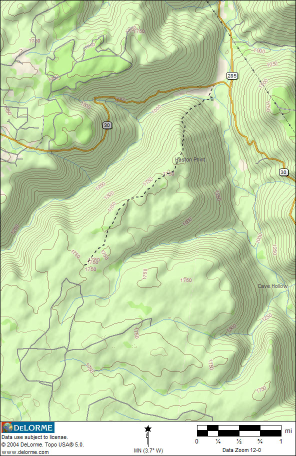
Haston Point

Haston Point is located on top of the mountain between Spencer and Cane Creek.  This land was part of James A. Haston's holding before the Civil War.  There was a large saw mill site there and a large timber operation.  The mill closed in the 1880's.  There is a jeep road which runs from south west of Spencer at the Goforth Road which is a remnant of this operation.  --Dwight Haston (August 28, 2005)

Haston Point - in Van Buren County, TN